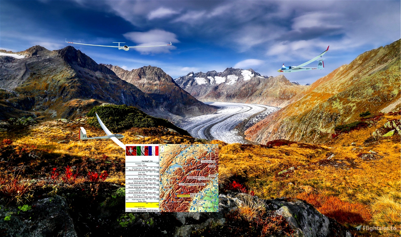


Distance:317km.Length:1h-3h.Difficulty:hard.
From:LSMI Interlaken to LFLJ Courchevel. ..
----
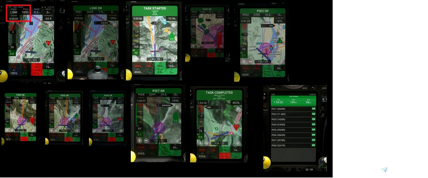
Use and look to GPS to validate all crossing points (notification when done).
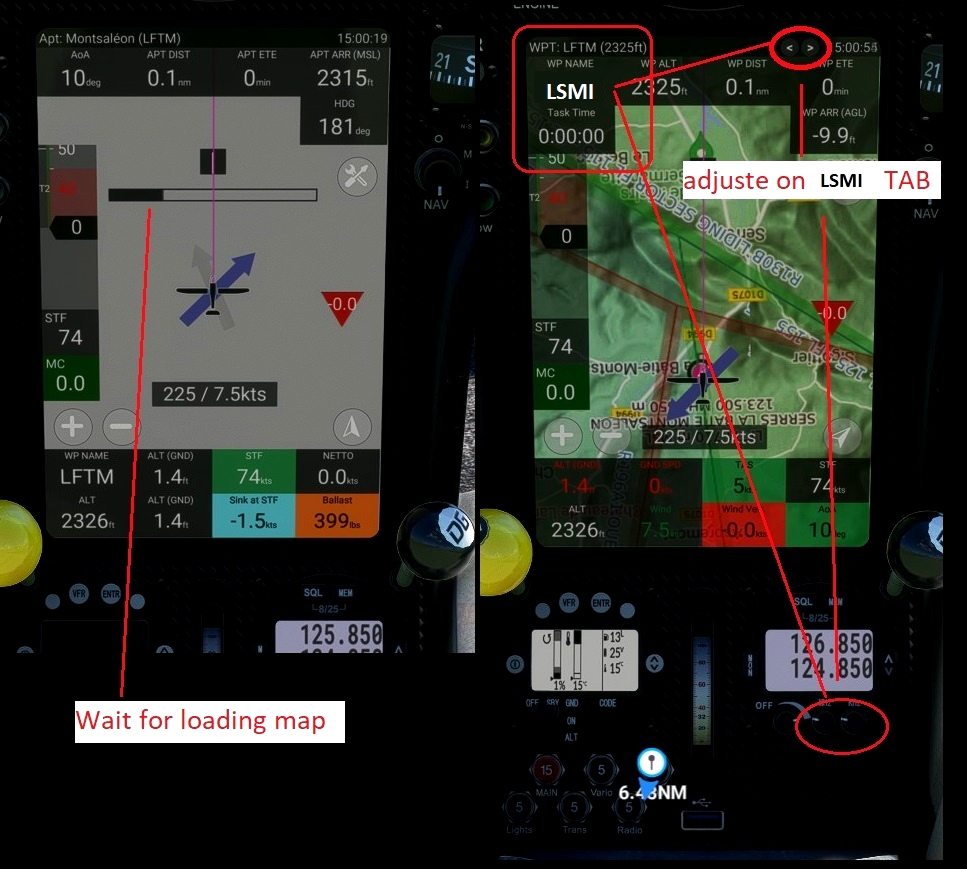
Watch your GPS and wait for the map to finish loading.
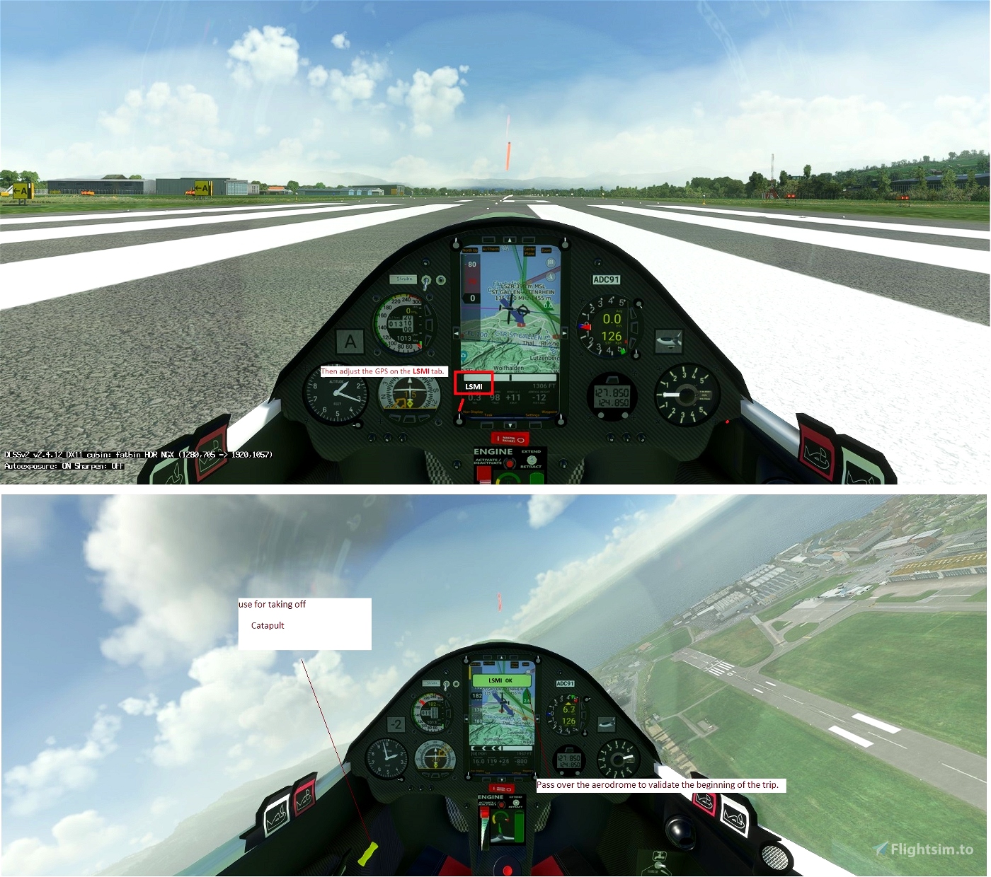
Then adjust the GPS on the LSMI tab .
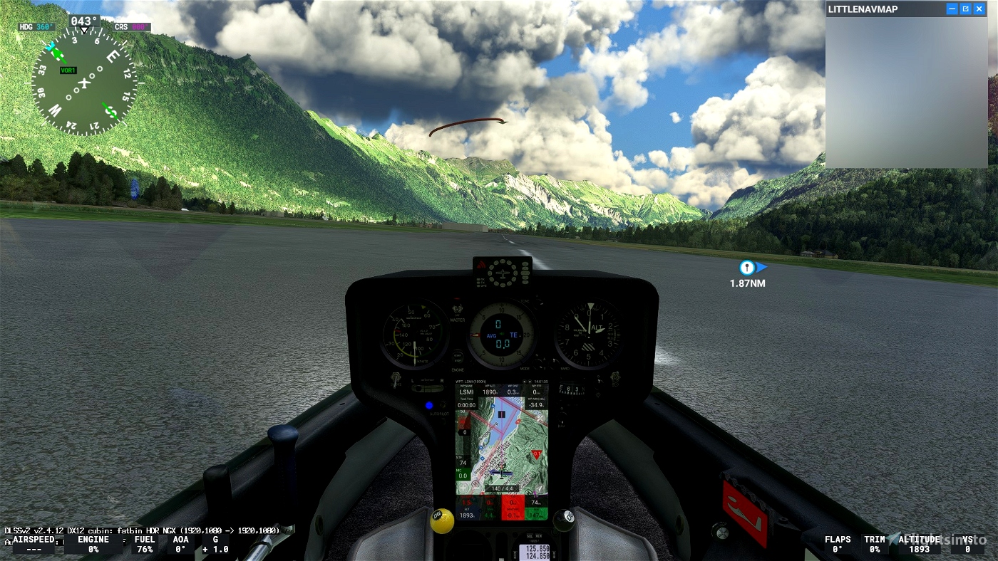
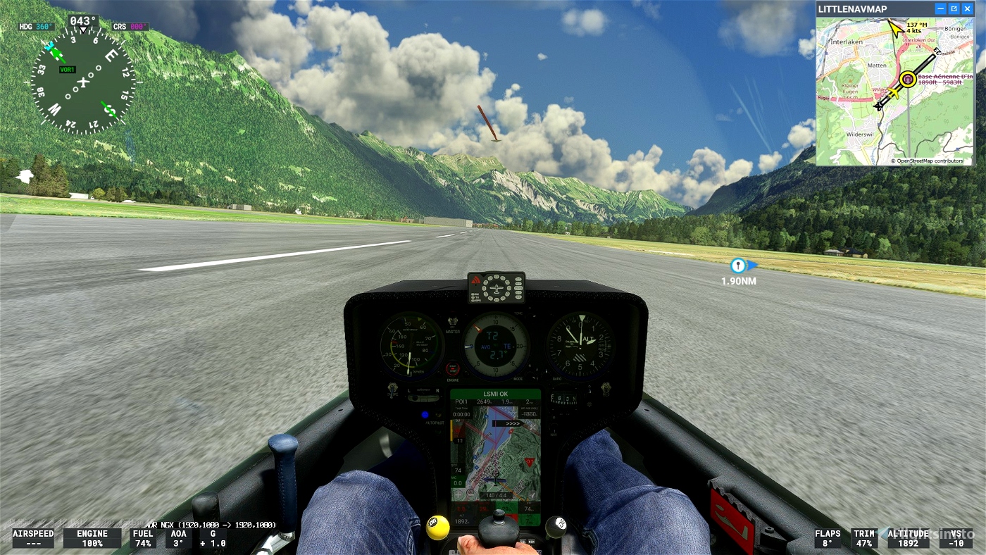
Start your engine to reach 6000 feet.
Pass over the aerodrome to valid LSMI
Make sure that you have validated the crossing point above the aerodrome.
Start your engine to reach 6000 feet.
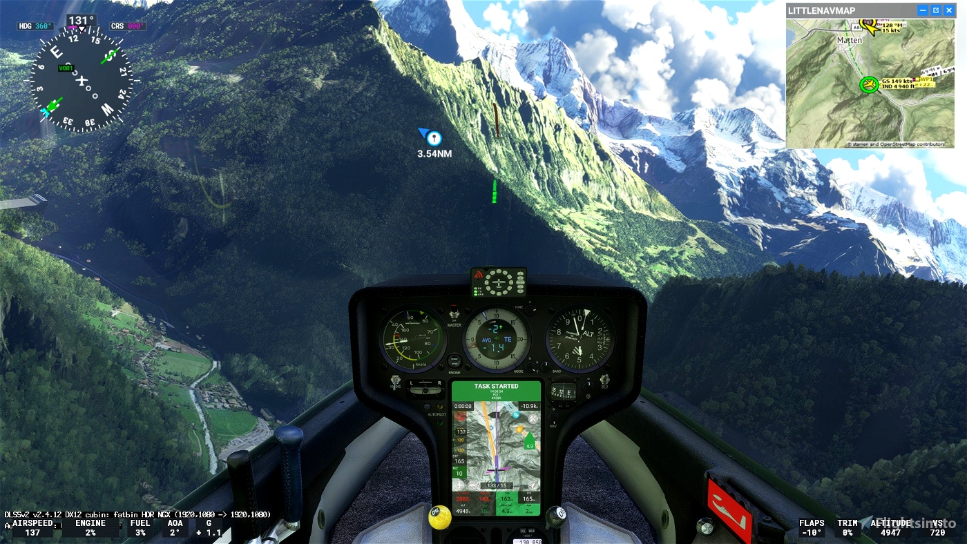
6000 feet is the Maximum height to pass the POI1 start line.
LSMI Interlaken 1872 FEET
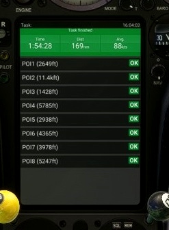
OK go to POI1: Starting line. Elevation 6000 feet maximim
OK go to POI2 Vorderes Galmihorn Elevation 11079 feet maximim
OK go to POI3 Domodossola Elevation 10000 feet maximim
OK go to POI4 Zermatt Elevation 10000 feet maximim
OK go to POI5 Sembrancher Elevation 10000 feet maximim
OK go to POI6 Les Contamines Montjoie Elevation 10000 feet maximim
OK go to POI7 Noasca Elevation 10000 feet maximim
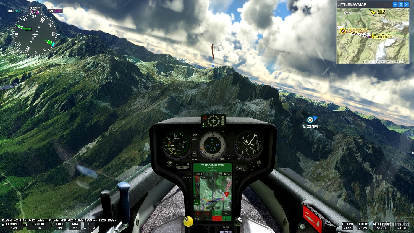
OK go to POI8:FINISH LINE . Elevation 2000 feet maximim
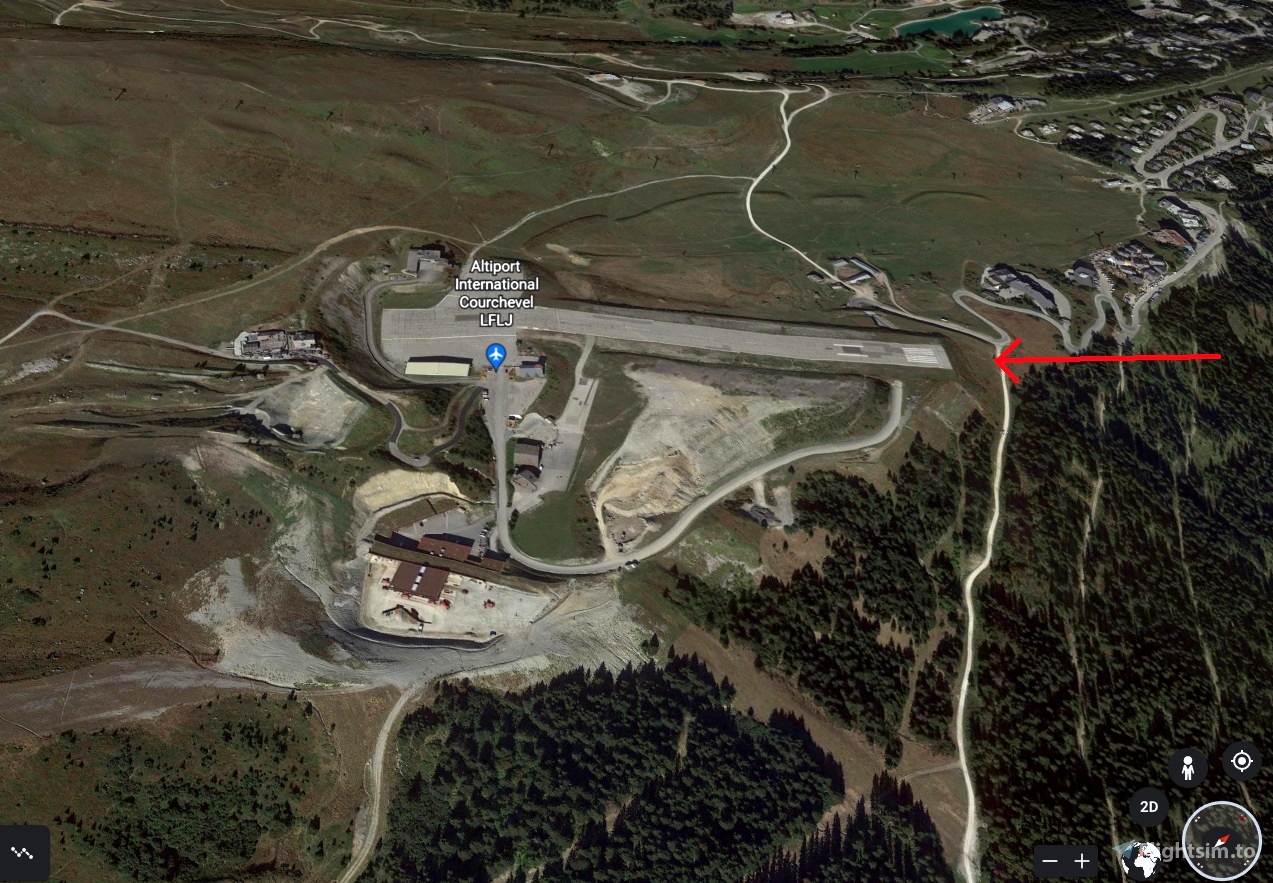
go Landing on Courchevel Airport - LFLJ 1057 feet
Turn off your main battery when you have landed

 ADCKillerman

