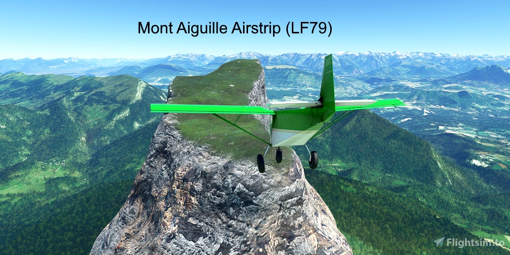
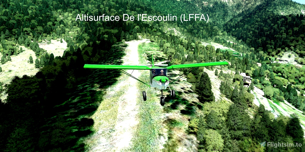
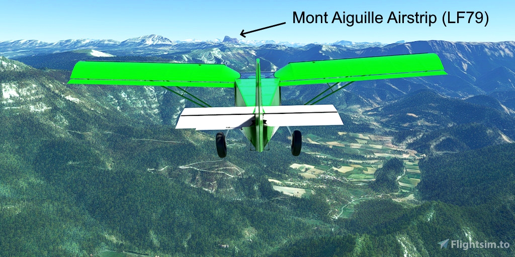
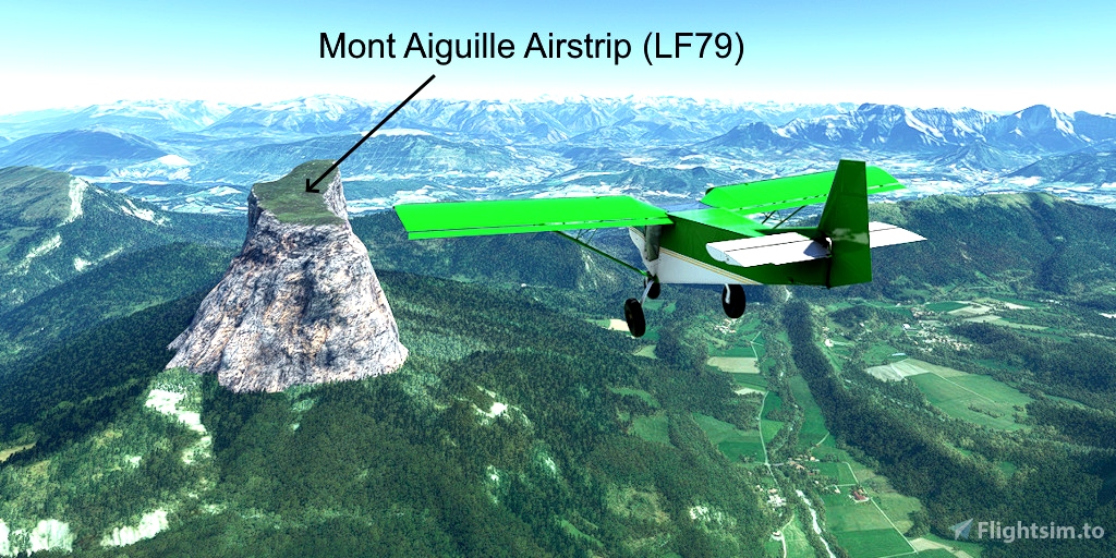
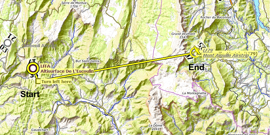
Depart from a small downhill grass airstrip (Altisurface de l'Escoulin) and fly to a steep uphill butte (Mont Aiguille Airstrip). The Mont Aiguille Airstrip has no ground markings and it is very steep, uneven, and slants to the left and right sides. It may take several attempts to master landing on it.
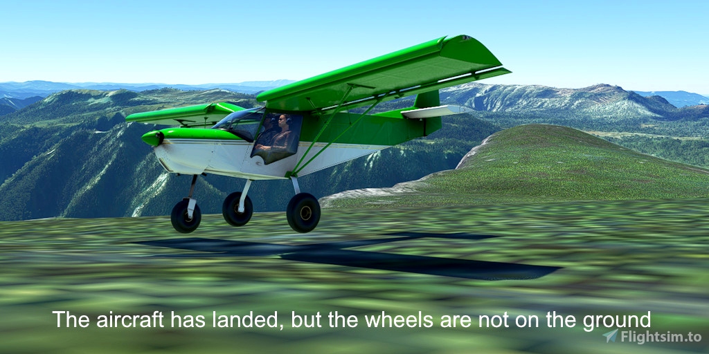
The terrain appears to be an MSFS anamoly. The airport marker is displayed very high above the surface, and when you stop, you will see that the aircraft wheels are not touching the ground.
Runway that departs in the direction of the flight plan: 17
Distance: 15 miles
No navigation or GPS instruments are required; simply follow the on-screen markers.
Do not engage the copilot or autopilot. They may alter or suppress waypoints.
MSFS settings for the best experience with this flight plan: Options > Assistance Options >
- Piloting > AI Radio Communications (ATC) > Off (required to properly display the waypoints)
- Navigation Aids > Route and Waypoints > On
- Points of Interest > Landmark Markers > On
- Points of Interest > City Markers = Off (optional - declutters the screen)
- Points of Interest > Display Direction to Chosen POI > Off (disables the confusing destination marker)
- Points of Interest > Display All Labels > Off
- User Experience > ATC Enforce Flight Plan > On (prevent current conditions from overriding selected runway number)
How to Use This Flight Plan
- Unzip the downloaded file into any folder.
- The flight plan is the file that has the “ .pln ” filename extension.
- MSFS > Welcome tab > World Map > Press Spacebar twice (More > Load) > Load From ...
- Navigate to where you saved the flight plan and select it.
- In the "From" airport, select the departure runway (provided in this description, above).
- Click on the Flight Conditions window at the top right to adjust time and month.
- Click on "Fly" at the bottom right of the screen.

 FederFlyer

