


Mozambique Missing Airfields v0.2.0
===================================
Head to South-eastern Africa for some stunning scenery, spectacular wildlife and remote locations. Included in this package are 16 Mozambican airfields previously unavailable in MSFS. These are mostly basic sceneries, but they have all the required starting locations (including a parking spot or two), a windsock, plus a few bits of bling to make them a little more interesting. I've also terraformed many of the runways to present realistic slopes and corrected water masks and vegetation in some places.
As mentioned, none of the fields are currently included in MSFS, and most aren't even listed in the Ourairports database. Most of them, as far as I'm aware, don't have ICAO codes, so I made them up. The fields are as follows:
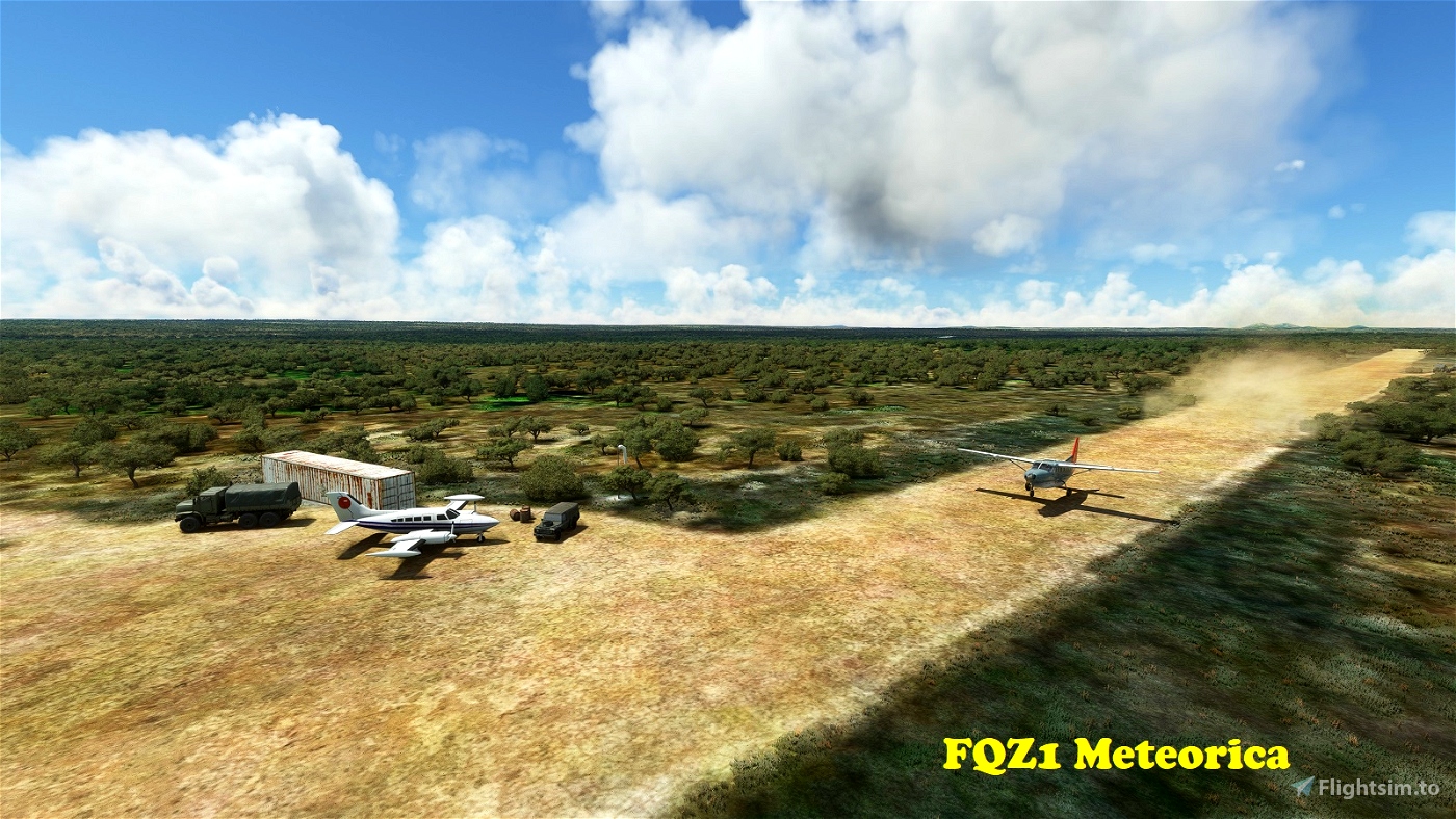
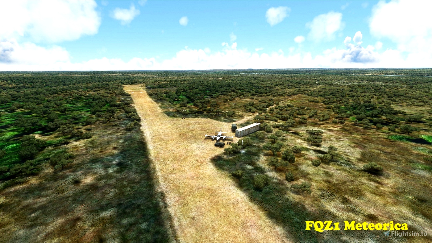
FQZ1 Meteorica
--------------
Meteorica is located in Niassa Province in far northern Mozambique. This is remote, semi-arid country with few facilities. The strip is located near the banks of the Lugenda River and possible has military uses. It has a 846m long dirt runway that's oriented 06/24. Elevation is 1,532'.
-12.8208 36.782021
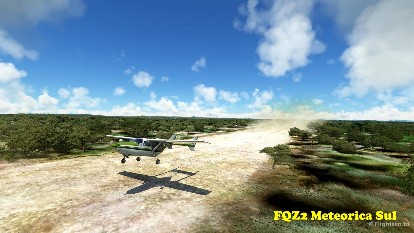
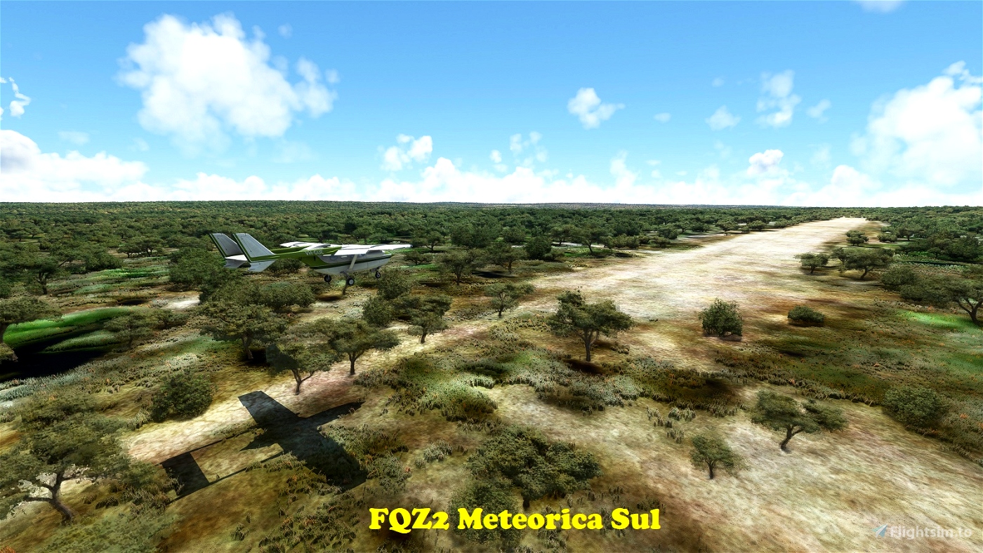
FQZ2 Meteorica Sul
------------------
Located 8km (4.5nm) south of FQZ1 is a short dirt strip, possibly used by hunting parties. It has a 610m long dirt runway oriented 13/31. Elevation is 1,585'. There are no facilities and vegetation is encroaching from all directions, so be careful!
-12.889729 36.762525
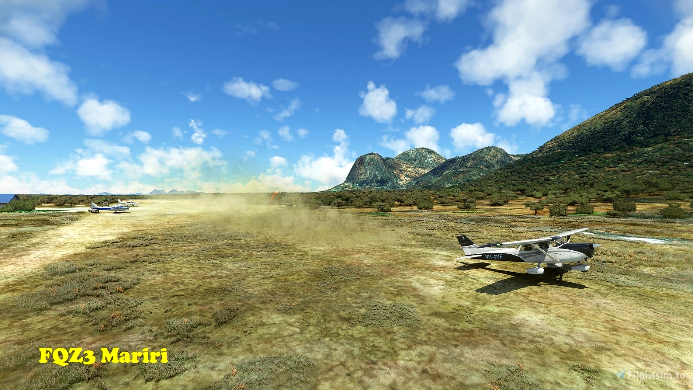
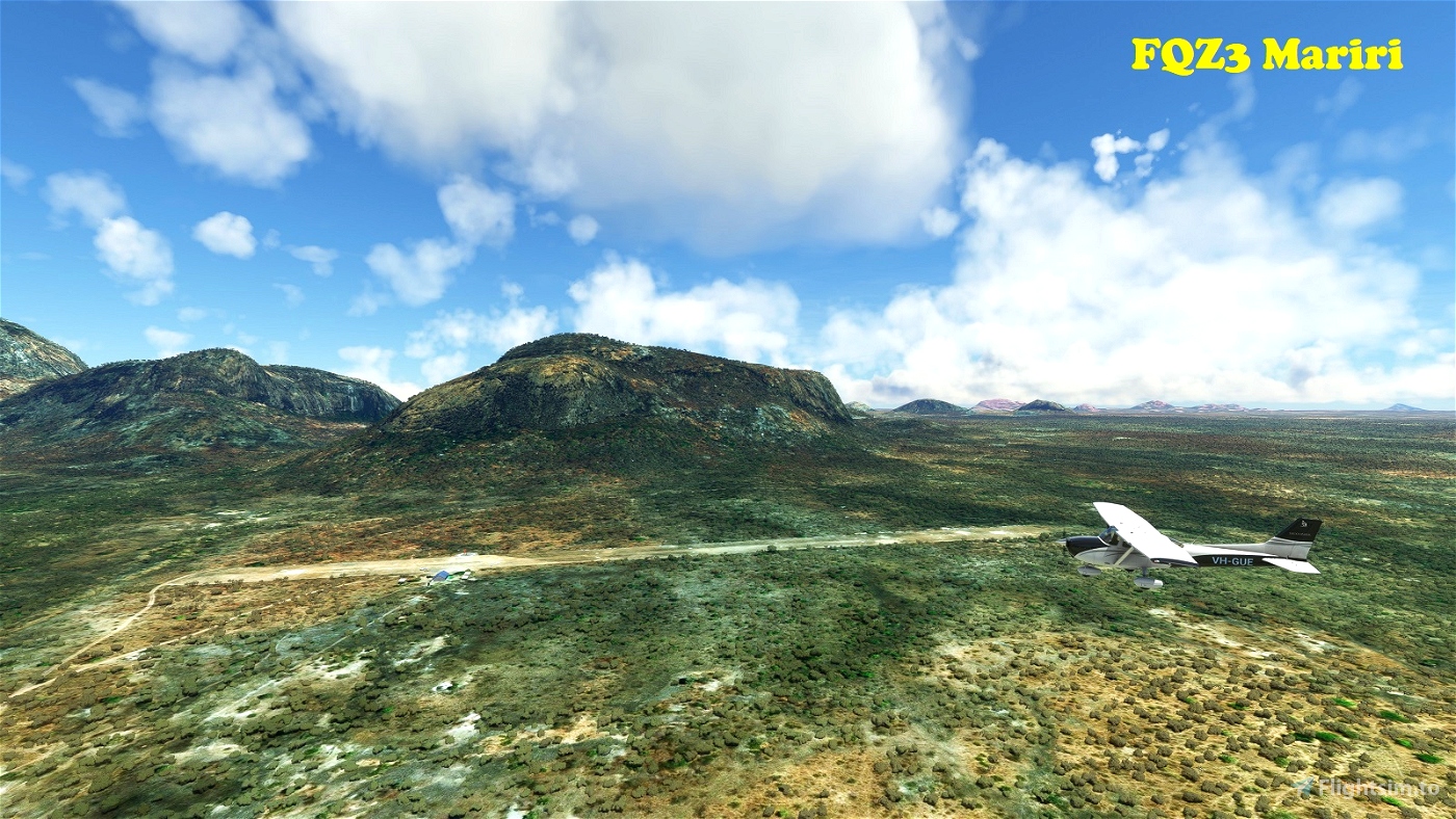
FQZ3 Mariri
-----------
Mariri is a Safari Lodge, also in Niassa Province in northern Mozambique. It sits among the spectacular granite outcrops of the Mariri Mountains, on the banks of the Lugenda River. The runway is well maintained dirt/grass (depending on the season), is 802m long and oriented 06/24. Elevation is 833'. Traffic for Runway 06 is right-hand only ... you'll realise why, if you ever visit!
-12.168229 38.089448
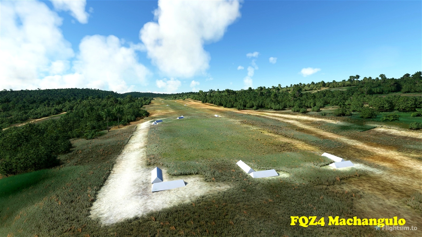
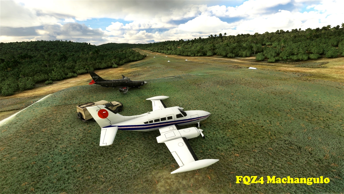
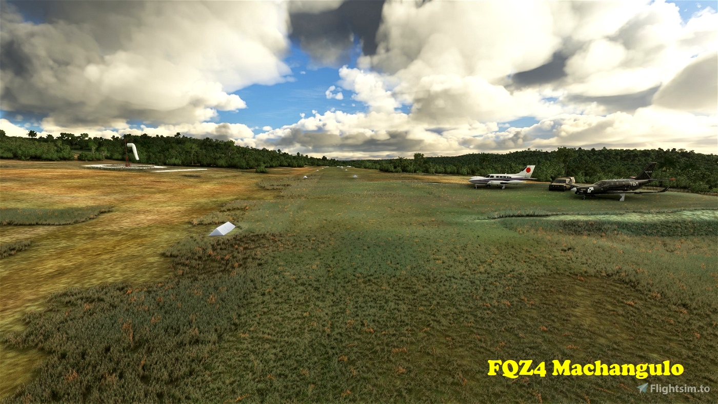
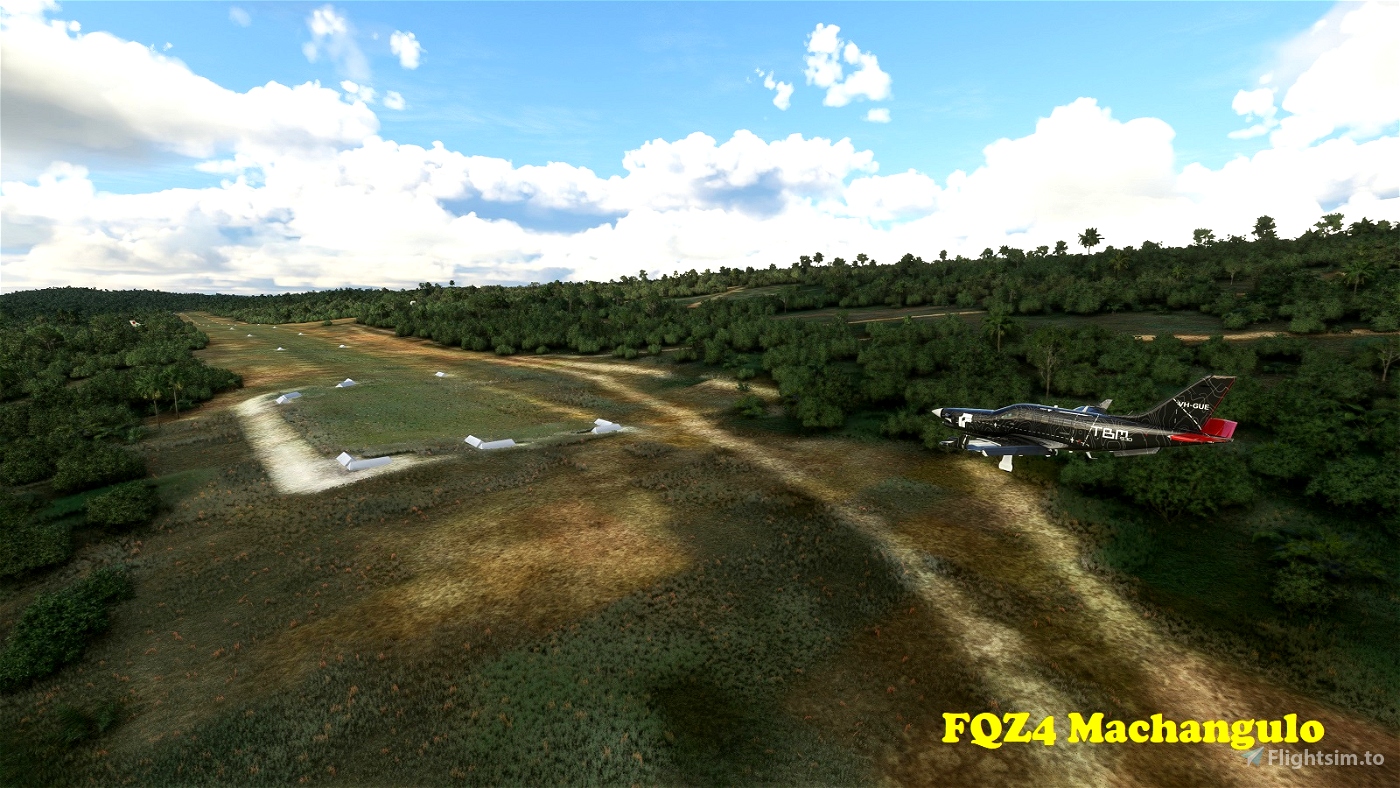
FQZ4 Machangulo Nature Reserve
------------------------------
Located on the Machangulo Peninsula in Maputo Province, in southern Mozambique, this airfield serves a private luxury "nature reserve", though what's being preserved is primarily a certain lifestyle. The 1,138m long grass strip is quite narrow due to the side slope it has been built on. The runway ends and parking area have been levelled and extended to provide a safer operating environment. The strip slopes up towards the north, making Runway 02 preferred for landing, 20 for take-off. Elevation is 121'.
-26.199803 32.934144
[Update 0.2.0: The following are new additions:]
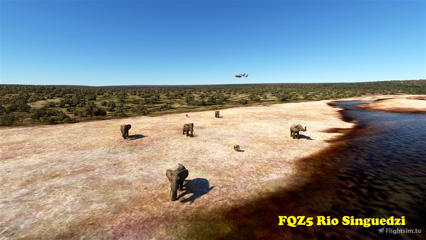
FQZ5 Rio Singuedzi
------------------
This very basic dirt strip is located in Gaza Province, right at the border with South Africa, where the Shingwedzi River changes its name to Rio Singuedzi. It's part of the Limpopo National Park, which extends from the more touristy Kruger National Park across the border. Although the Rio Singuedzi is dry for much of the year, it leaves behind many waterholes during the dry season, attracting the local wildlife, including African bush elephants. Keep a lookout! Runway 03/21 is 889m long. Field elevation is 793'.
-23.221075 31.589687
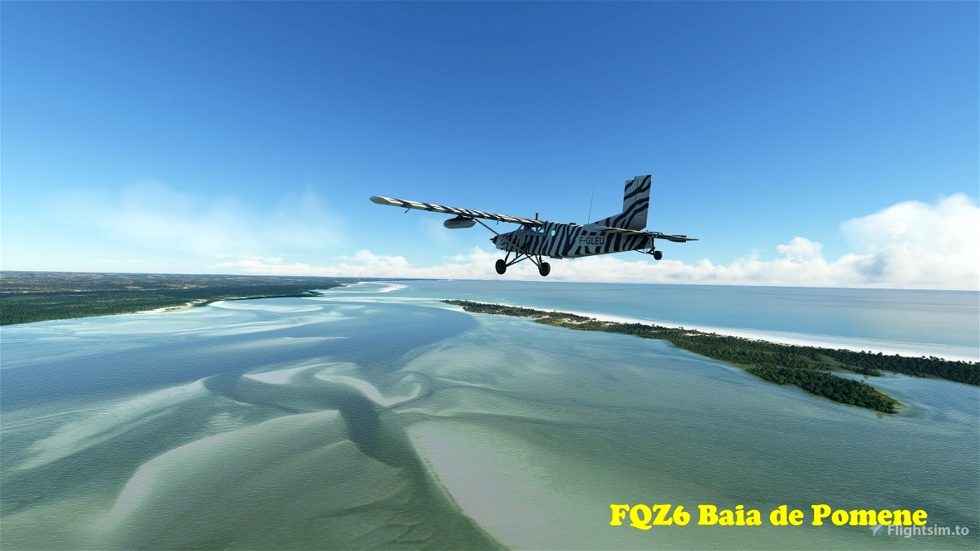
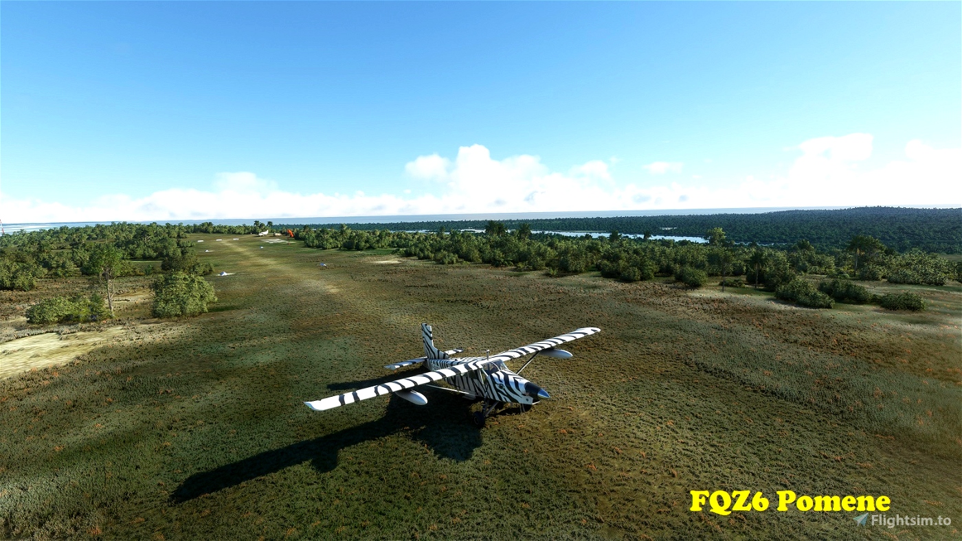
FQZ6 Pomene
-----------
Located in the Pomene Natural Reserve in Inhambane Province, this 738m long strip serves the nearby tourist lodges. The field overlooks the crystal-clear waters of the Baia de Pomene. Runway directions are 17/35. Field elevation is 177'.
-22.942476 35.570308
FQZ7 Bebelhane Farm
-------------------
This strip belongs to a farm in Maputo Province, in Mozambique's far south. Runway 16/34 is 877m long. Field elevation is 180'.
-26.748068 32.321041
FQZ8 Majute
-----------
Located in the Maputo Special Reserve. Runway 01/19 is 615m long and quite narrow. Field elevation is 49'.
-26.507492 32.721978
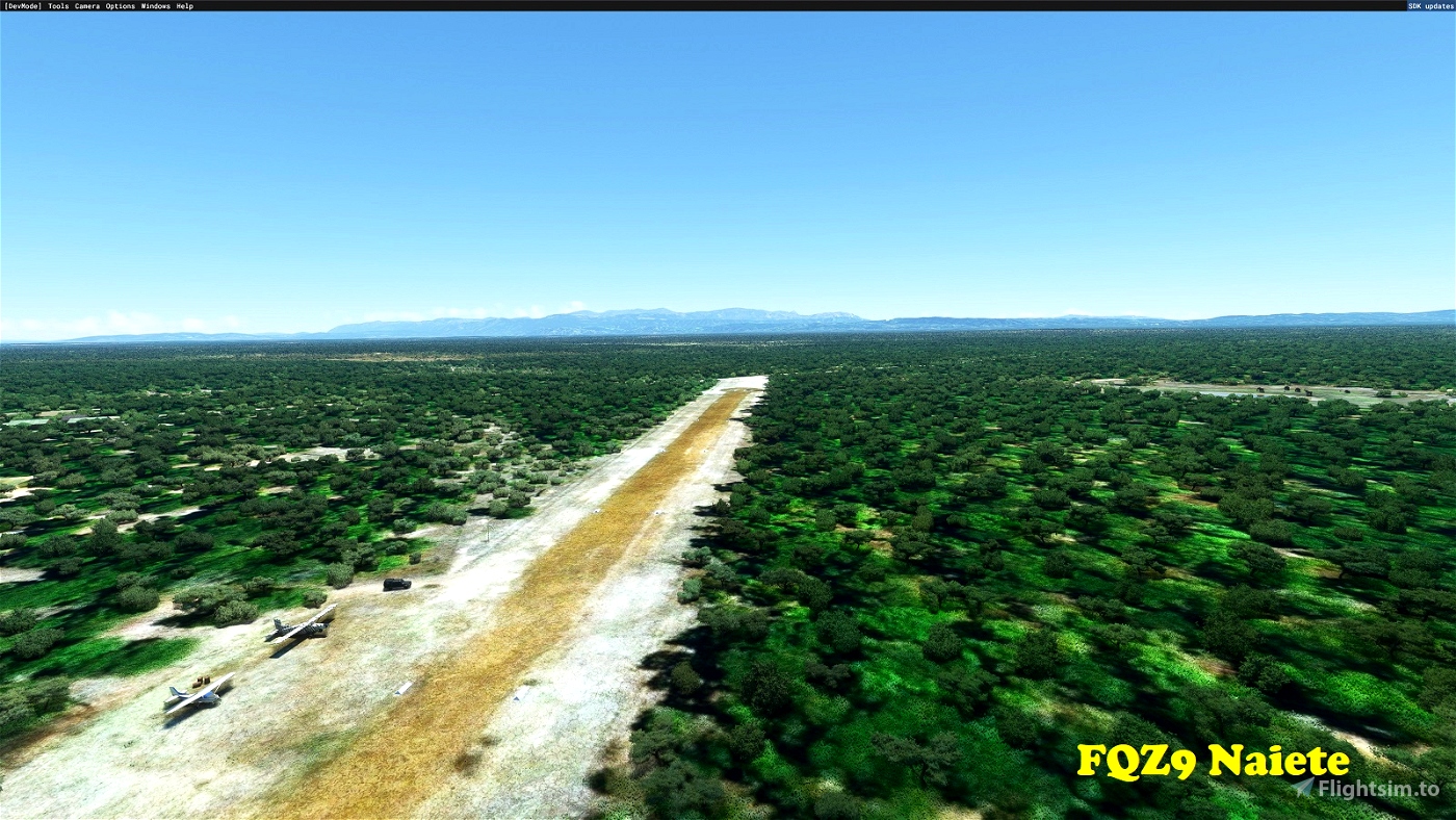
FQZ9 Naiete
-----------
Located at the centre of a large forest reserve in Manica Province, this is a well maintained 805m long dirt strip, oriented 12/30. Taking off into the west opens up a splendid vista towards the Chimanimani Mountains at the border with Zimbabwe and Monte Binga, Mozambique's highest. Bush elephants are often seen in the lagoons to the north. Field elevation is 505'.
-19.828939 33.543012
FQY1 Gorongosa
--------------
Serving the town of Gorongosa in Sofala Province, this field is located on a ridge in the town's southern outskirts. Nearby attractions are Mount Gorongosa to the north and Gorongosa National Parl to the east. The strip is rather short (609m) and slopes moderately up towards the southeast. Runway direction is 14/32. Field elevation is 1,358'.
-18.705973 34.079582
FQY2 Montebelo Gorongosa Lodge
-----------------------------
This strip services a safari camp inside Gorongosa National Park. The once spectacular park has suffered immensely during the Mozambican Civil War, but is now slowly being restored. Runway 05/23 is 1,078m long. Field elevation is 1,000'.
-18.975099 34.357296
FQY3 Mandimba
-------------
Located near the town of Mandimba, Niassa Province, near the border with Malawi. The dirt Runway 14/32 is 987m long.
Field elevation is 2512'.
-14.339087 35.6628
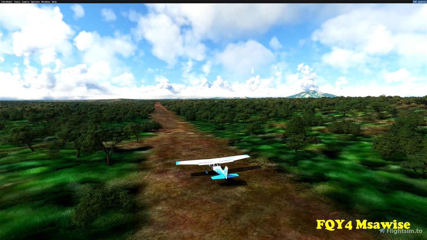
FQY4 Msawise
------------
Msawise is a small village in the Niassa Reserve in northern Mozambique. This is longish (1,006m) dirt strip, but very narrow, with vegetation encroaching on all sides. Anything with a bigger wingspan than a C172 is asking for trouble. Runway orientation is 01/19. Field elevation is 1,896'.
-12.60131 36.554548
FQY5 Niassa Reserve
-------------------
Located 20nm NNE of FQY4 Msawise, this short (575m) and moderately steep dirt strip serves the Niassa Reserve. Runway direction is 17/35. Field elevation is 2,054'.
-12.297496 36.696028
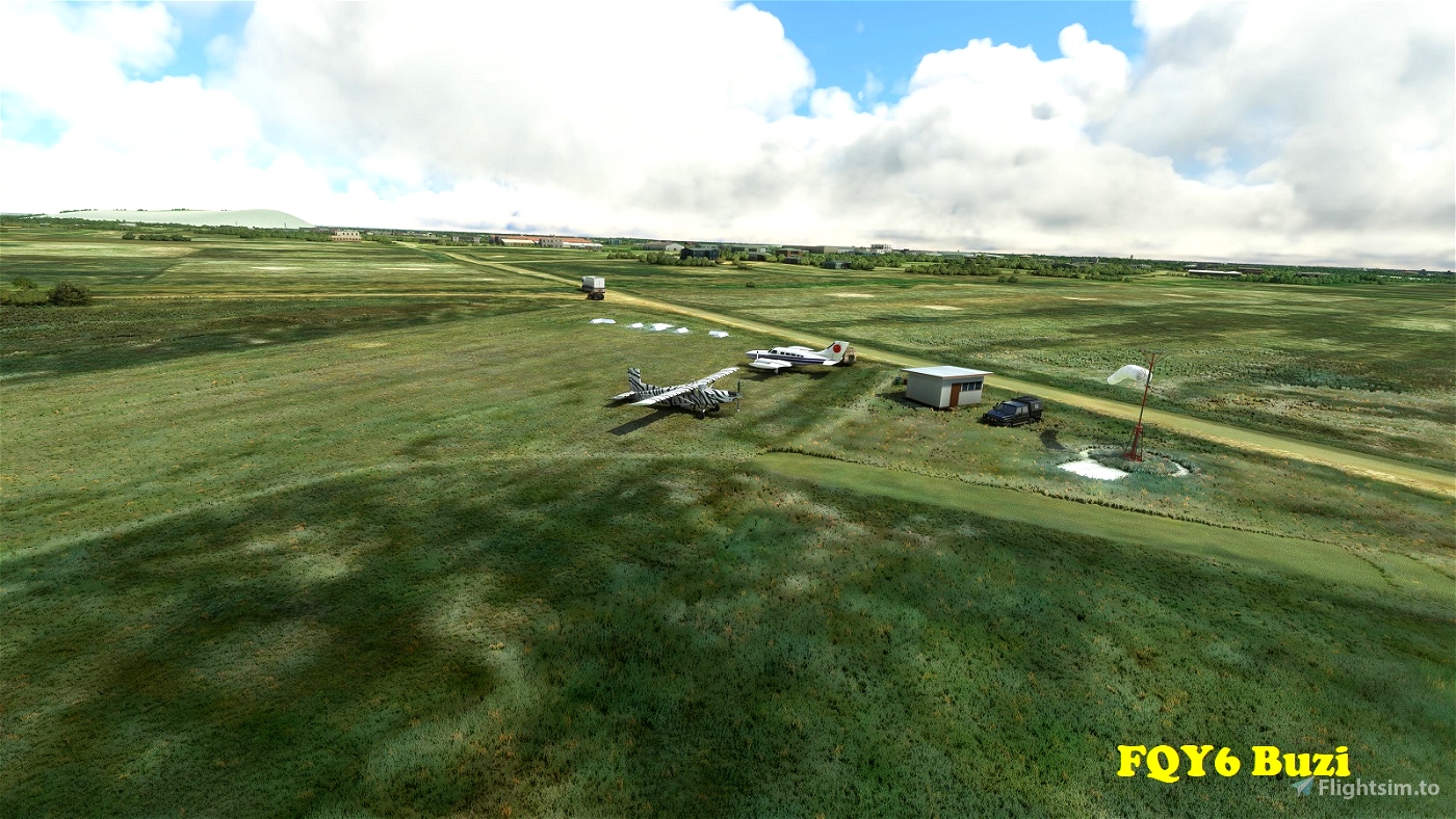
FQY6 Buzi
---------
About 15nm west of the Sofala provincial capital Beira, Buzi is a centre for sugar production along the Buzi River. Runway 01/19 is 856m long. With a field elevation of only 20', the surrounding area is often inundated by the annual flooding of the Buzi River.
-19.896556 34.584855
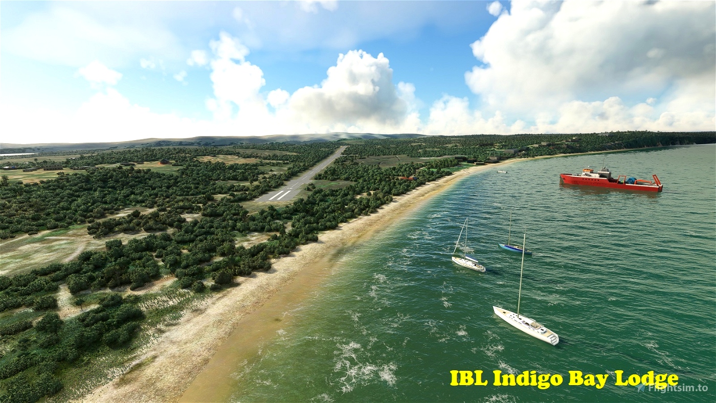
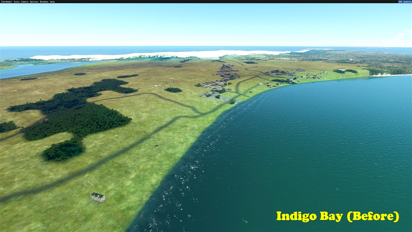
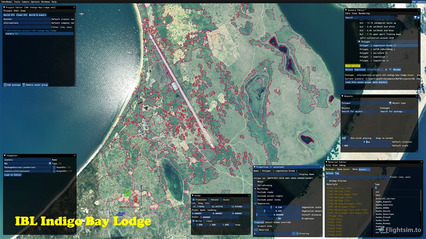
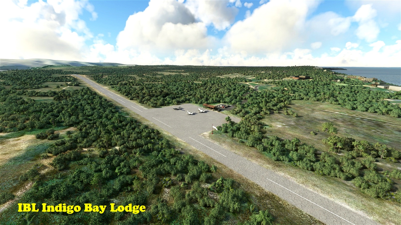
IBL Indigo Bay Lodge
--------------------
And last but not least ... located on Bazaruto Island in Inhambane Province, this airfield serves the tourist resorts at Indigo Bay. In MSFS the field and surrounding area is covered in generic textures only because of cloud on Bing maps. I have reconstructed the area using Google imagery (the reason this download is 100MB rather than a few hundred KB) and populated it with appropriate vegetation and buildings. Runway 16/34 is 1,490m long (though quite narrow). Field elevation is 16'.
-21.705659 35.451291
Installation:
=============
Simply copy the included folders into your Community folder. (If you are updating this scenery to a newer version, first delete the existing folders of the same name.)
Dependencies:
=============
To see the scenery objects I've placed, you will need to have the following object libraries installed:
MSFS 2020 object library with 190+ models ranging from towers hangars to cones by colinj
https://flightsim.to/file/16007/msfs-object-library-with-150-models-ranging-from-towers-hangers-terminals-to-cones
totof- aircraft library by Totof33120
https://flightsim.to/file/17182/totof-aircraft-library-v1-1
totof- helicopter library by Totof33120
https://flightsim.to/file/17983/totof-helicopter-library-v1
Mikea.at - Airport Markings by mikea.at
https://flightsim.to/file/4208/mikea-at-airport-markings
Mikea.at - AssetPack by mikea.at
https://flightsim.to/file/1923/mikea-at-assetpack
Windy Things by trfsto
https://flightsim.to/file/14024/windy-things
Static Boats 3D Model Library by superspud
https://flightsim.to/file/27907/static-boat-3d-model-library
Collection d'avions pour FS2020 by Jean-Pierre Fillion
https://www.jpfil.com/quebec-fs2020/scenes/Collection-avions.zip
Credit: Jean-Pierre Fillion, Quebec
quebec-fs2020.org
jpfil.com
Many thanks to the library object developers for making them available!
[Note: the scenery will function without these libraries, but will look less interesting.]

 gunther


Thank you for your work!
2 years ago
sarahymac
FQZ6 Baia de Pomene windsock is 180 degrees off. Normally when you place a windsock you have to 0 its heading maybe you forgot. Didn't check the rest of the airports.
2 years ago
Thank you. I'm aware of the issues with the default windsock, which is one reason why I use colinj's and Windythings windsocks in my sceneries (at FQZ6 it's colinj). I've now re-checked this scenery in the editor, and the windsock is also at 0 degrees heading. And when loaded in the sim I'm seeing the (correct) expected behavior. Can you please make sure you are using the latest versions of the object libraries listed as dependencies, and that no other add-on is interfering.
2 years ago
gunther
SJK